TurQuosian

Eastern Türkiye

Ani

A medieval capital on a shut border

Ani was the Bagratid Armenian capital from 961, a city of grand churches on a plateau that now ends at a closed border with Armenia. UNESCO-listed since 2016, it is overwhelmingly visited by domestic Turkish travellers — genuinely remote and extraordinary rather than a well-known international stop. Base yourself in Kars, 42–45 km away.

Stay
2 days, with Kars
From Kars
~45 km, 30–60 min
Entry (foreign)
€8 (2025–26)
UNESCO
Listed 2016
Best months
May–Sep
2025 visitors
156,625, 94% domestic

Every published place in one city guide

What to see in Ani.

Start with the essentials, add what genuinely interests you, and leave the rest for another visit. Every place includes a concise story, practical timing, a Maps link, and a one-tap route planner action.

Make the route work

Anticipate the practical details.

Getting there

Base yourself in Kars — there is no realistic alternative; Ocaklı, the village beside Ani, has no visitor accommodation. Kars Harakani Airport (KSY), 6km from town, has flights from Istanbul (Turkish Airlines, Pegasus), Ankara (AJet) and İzmir (SunExpress). The Doğu Ekspresi (Eastern Express) sleeper train from Ankara is a roughly 32.5-hour journey and an attraction in its own right — a premium three-times-weekly Touristic Eastern Express also runs — but plan on flying if Ani is a stop on a wider trip rather than the whole point of it.

Getting around

Ani is 42–45km from central Kars on a paved highway to Ocaklı village, then a short lane to the gate — 30 to 60 minutes depending on where you start and the road. A taxi arranged through your hotel is the standard, reliable option. A public minibus reportedly runs from Kars at 09:00, returning at 12:45 (around 100 TL return, 2025), but this could not be confirmed to operate outside summer — do not rely on it without checking locally first. Budget 2 to 4 hours to walk the full site; it is one ticket, one gate, no internal transport.

Money

Foreign-visitor entry is €8 (2025–26); Turkish Müzekart holders enter free. There is no card machine at the gate and no ATM nearby — bring Turkish lira in cash from Kars.

Etiquette

This was the medieval Armenian Bagratid capital, and most of what stands is church architecture — treat it with the same respect as any religious ruin, including not climbing on unstable fabric. The site sits directly beside the closed Turkey–Armenia border; current visitors photograph freely (no active restriction was found), but avoid zoomed-in photography of the watchtowers or military positions across the gorge as a matter of ordinary sense, not because a specific rule requires it.

Safety and comfort

A high, exposed plateau (roughly 1,340m) with no shade or shelter anywhere on site. Winters are genuinely severe — nearby Kars averages around −15°C in January with a record low of −37°C, and the region holds snow cover for roughly four months a year — the site stays open, but conditions can be harsh underfoot. Several structures have unstable edges (the cathedral's northwest corner, the Church of the Holy Redeemer's collapsed half); stay off broken fabric even where it looks stable enough to climb.

Essential

Don’t leave without

If you only have one day, this is the day.

Rank1
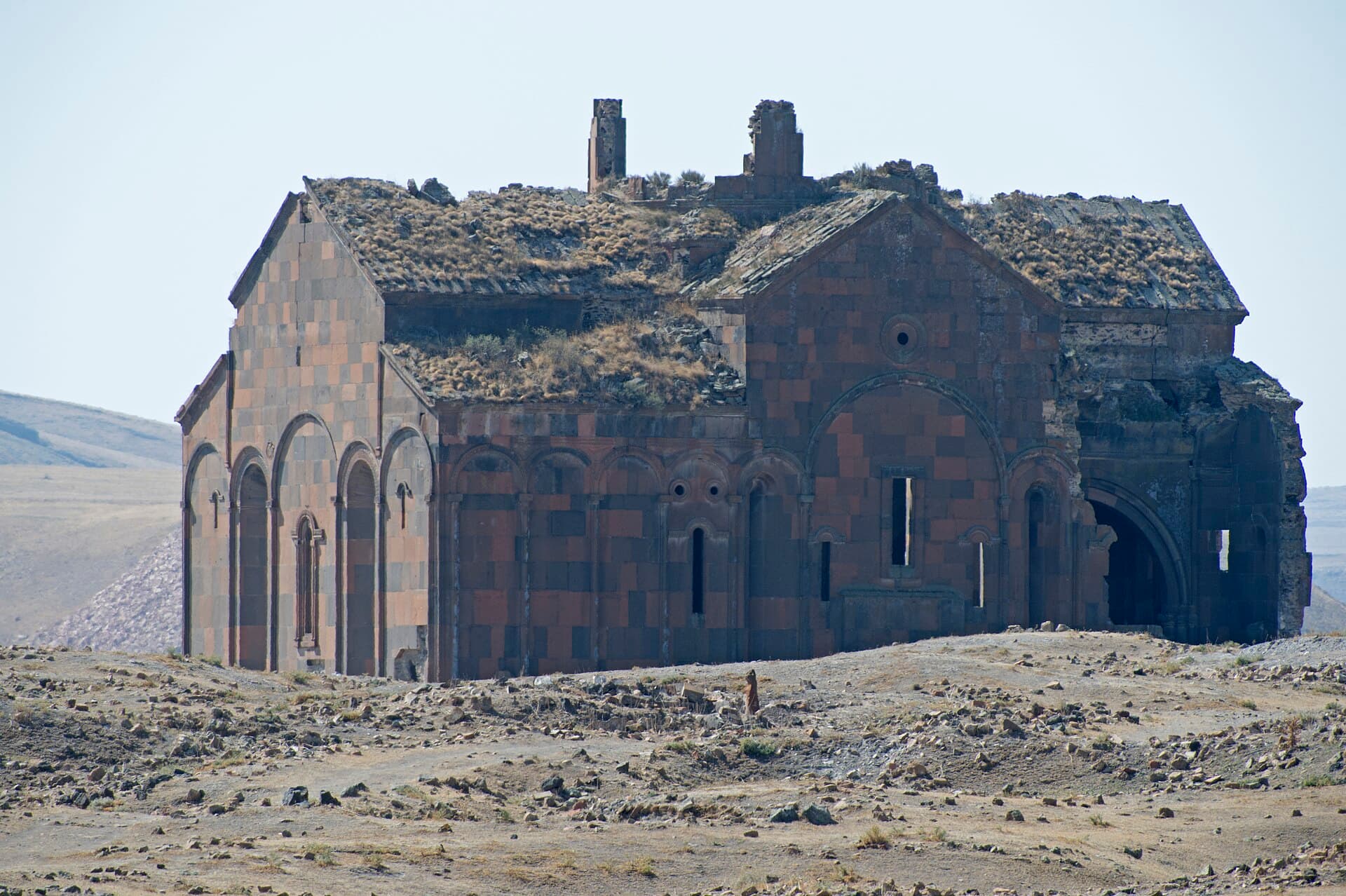
Ruined Cathedral of Ani's roofless stone exterior walls against open sky

Cathedral of Ani

Religious site

Trdat built this and, in the same years, rebuilt Hagia Sophia's dome for Constantinople. Only one of the two still stands with its dome on.

Begun 989 under King Smbat II, completed by about 1001, designed by Trdat — the architect Byzantine officials summoned to Constantinople after 989's earthquake to rebuild Hagia Sophia's dome. Its pointed arches and clustered piers predate Western Gothic architecture by two centuries. Became a mosque (Fethiye Camii) after the 1064 Seljuk conquest; reconsecrated in 1124. The dome collapsed in the 1319 earthquake.

30 minThe northwest corner was damaged in the 1988 earthquake and is fenced off — a real structural hazard, not a barrier around a finished exhibit.No roof and no shade; the interior is as exposed to sun, wind and cold as the plateau outside it.Ground and threshold stones are worn and uneven underfoot, and can ice over in winter.
+1 more to know
Covered by the single Ani site ticket — no separate charge.
Look for: The scar where the dome once sat, visible from inside looking up at open sky. The northwest corner, torn open by the 1988 earthquake and now fenced — real damage, not a reconstruction gap.
Verified · · 6 min to Church of the Holy Redeemer · 8 min to Church of St Gregory of Tigran Honents
Rank2
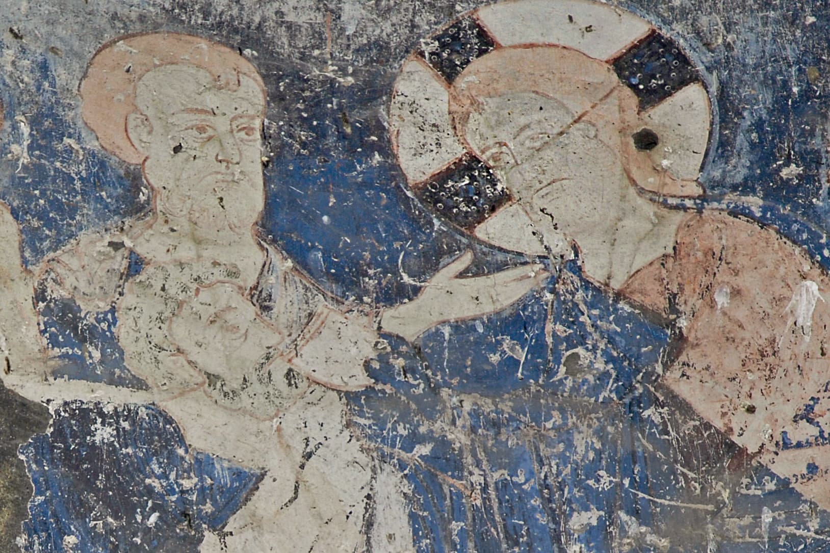
Last Supper fresco with haloed figures on a blue ground, Tigran Honents church

The best-preserved building at Ani, and the only one where the paint survived, not just the stone.

Completed in 1215, per an inscription on the south façade, funded by Tigran Honents, a wealthy Armenian merchant who had already paid for restoration work at the cathedral. The best-preserved structure at Ani, notable for an extensive interior fresco cycle — believed painted by Georgian artists working for an Armenian patron — depicting Christ's life, the conversion of Armenia, and saints.

25 minNo artificial lighting inside; on an overcast day the frescoes are genuinely hard to see without your own light source.The frescoes are unprotected original pigment, not a reproduction — do not touch the plaster.The western gallery (zamatun) in front of the entrance is more ruined than the church and has uneven footing.
+1 more to know
Covered by the single Ani site ticket — no separate charge.
Look for: Carved interlaced dragons on the south exterior wall. Inside: the liturgical-feast cycle, scenes of Gregory the Illuminator converting Armenia, and an episode from the life of St Nino, apostle of Georgia, painted on Armenian soil.
Verified · · 4 min to Church of the Holy Redeemer · 8 min to Cathedral of Ani
Rank3
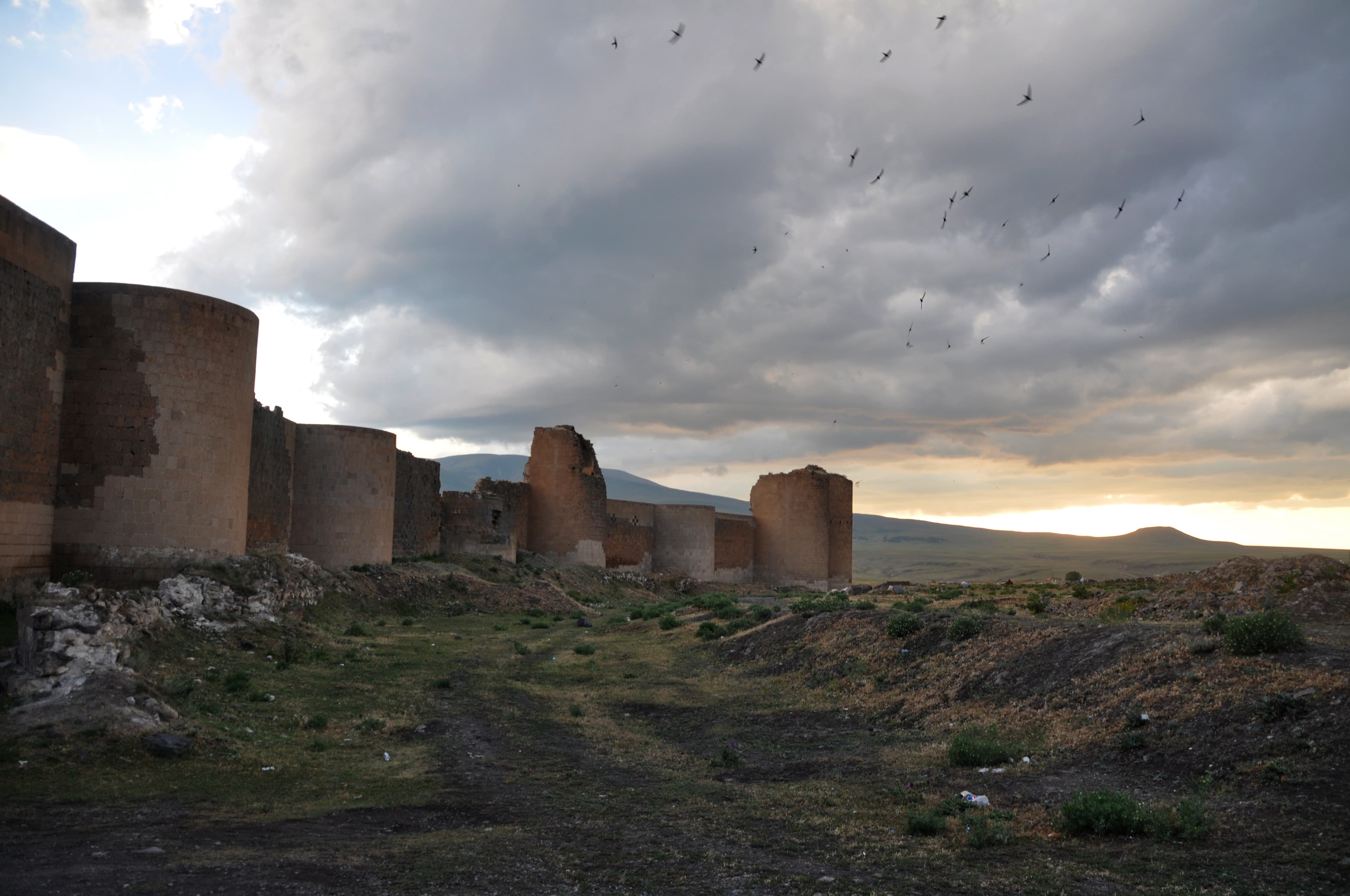
Ani's ruined medieval city walls with round defensive towers under a dramatic sky

The only side of Ani a medieval army could attack from — which is why it got the thickest, most heavily towered walls in the city.

Built by King Smbat II between 977 and 989, doubling the fortifications specifically on the plateau's north side, the one flank not already protected by a river gorge or valley. Later rulers raised the height and packed in semicircular towers. Damaged by the earthquake of 1319; the standing fabric was consolidated and partly rebuilt by the Ministry of Culture in 1996–97.

20 minThis is also the ticket entrance — arrive with cash; no card machine at the gate and no ATM nearby.Sections of the wall walk are uneven reconstructed and original stone side by side; footing needs attention, more so in ice or snow.No shade along the wall line, which runs fully exposed across the open plateau.
Look for: The carved lion relief on the inner wall beside the entrance, which gives the gate its name. Ten gateways originally pierced the circuit; most visitors see only this one and, on a longer walk, the well-preserved Kars Gate to the south.
Verified · · 9 min to Cathedral of Ani · 9 min to Church of the Holy Redeemer
Rank4
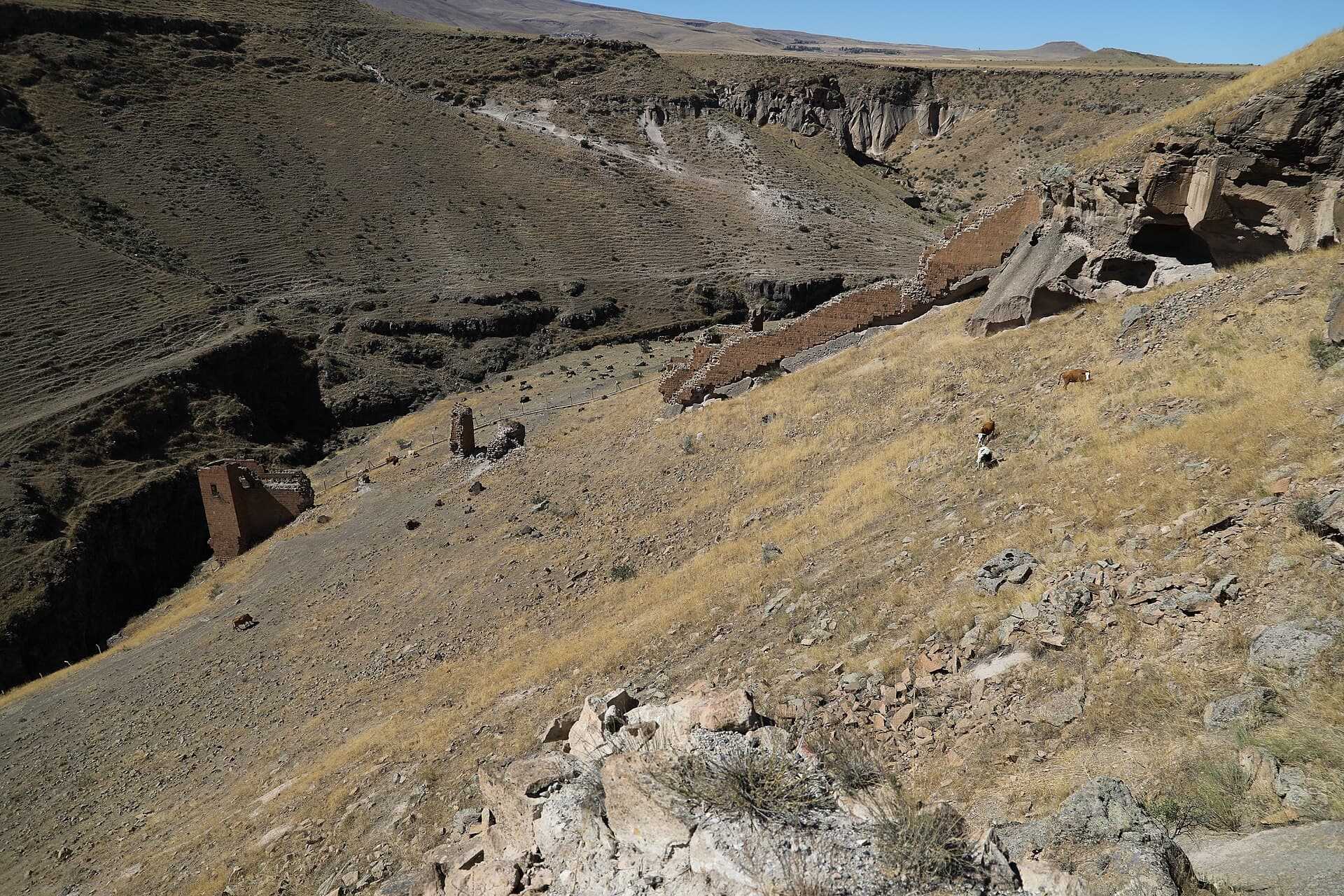
Ruined fortification walls of Ani's citadel above a deep river gorge

Citadel of Ani

Historic site

The southern tip of the plateau, where two gorges meet — and where Armenia becomes visible across a border that has been closed since 1993.

Fortified from before Ani was a capital, probably under the earlier Kamsarakan lords; the Bagratid kings later built their palace on its highest point. Three churches stood within its walls, including one thought to be the oldest surviving structure at Ani. Much of what remained collapsed further in a 1966 earthquake, on top of centuries of earlier damage.

30 minThis is an active international border zone, not a generic viewpoint. Photograph the landscape rather than zooming into military installations or personnel on either bank, as a matter of ordinary prudence — no specific rule against it was found, but it is not a place to test that.Ground within the citadel is broken, uneven ruin with open drops toward the gorge edge in places — supervise children closely.Furthest point on site from the entrance; budget return walking time, especially with only a few hours of winter daylight.
+1 more to know
Covered by the single Ani site ticket — no separate charge.
Look for: The Akhurian River gorge directly below, with Armenia on the far bank and a watchtower typically visible on each side. Foundation traces of the royal palace and the citadel's small "Church of the Palace," among the oldest fabric on site.
Verified · · 10 min to Cathedral of Ani · 15 min to City Walls and Lion Gate
Rank5
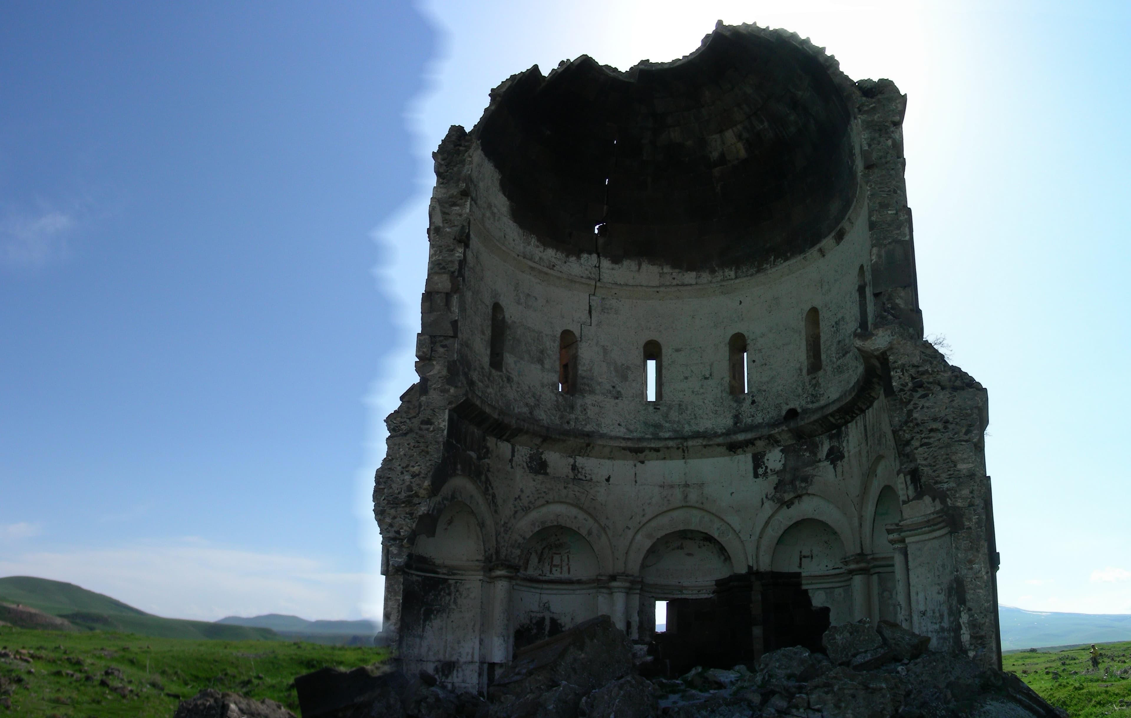
Half-collapsed medieval church at Ani, sliced open to reveal its domed interior

Half a dome, sliced clean through, still standing since a storm brought the other half down.

Consecrated in 1036, funded by the governor Ablgharib, said to have installed a fragment of the True Cross inside; restored again in 1193 and 1342. Built on an unusual plan — nineteen sides externally, eight apses internally, a tall drum under a dome. Its eastern half collapsed in a storm most accounts date to 1955; one source instead attributes the damage to an earlier, 1930s earthquake.

15 minThe collapsed edge is loose, unstable rubble, not a viewing platform — despite a visible worn path, do not climb onto the break.Sources disagree on the exact date and cause of the collapse (storm/lightning in 1955, or an earthquake in the 1930s) — treat the specific mechanism as unconfirmed.Covered by the single Ani site ticket — no separate charge.
Look for: The clean cross-section where the building simply ends — drum, dome curve and apse structure all visible in profile, more legible collapsed than most churches are intact.
Verified · · 4 min to Church of St Gregory of Tigran Honents · 6 min to Cathedral of Ani

Worth your time

Worth your time

A second day earns you these.

Rank1

Menüçehr Mosque

Religious site

Often called the first mosque the Seljuk Turks built in Anatolia — though it may have started life as something else entirely.

Built around 1072–1086 under Manuchihr, first ruler of the Shaddadid dynasty that took Ani that decade. Commonly cited as the earliest Seljuk-era mosque in Anatolia, though scholarship on the building itself notes it may not have been purpose-built as a mosque at all, but adapted from an earlier structure, possibly commercial. Under restoration since June 2020; current completion status unconfirmed.

15 minUnder restoration since 2020 with no confirmed completion date — scaffolding, partial closure, or restricted interior access are all possible. Verify current status before planning around it.The "first mosque in Anatolia" claim is a commonly repeated label; the building's actual origins and original purpose are debated among scholars.Covered by the single Ani site ticket — no separate charge.
Look for: The surviving minaret, carved with a Kufic "Bismillah" inscription. Multilingual inscriptions elsewhere on the building — Kufic, Persian, Georgian and Armenian — including a 1319 Mongol Ilkhanid tax edict.
Open in Maps
Rank2

Convent of the Virgins

Religious site

A small nuns' chapel on an isolated spur above the gorge — the last corner of Ani anyone lived in.

A small church on a hexa-conch plan (six apses around a central dome), on a rocky spur isolated from the main plateau, overlooking the Akhurian gorge. Commonly dated to the early thirteenth century by style, though some architectural elements may be as early as the eleventh. Thought to have housed a community of nuns; by tradition, the last monks anywhere at Ani did not leave this site until around 1735.

20 minSet apart from the main cluster of monuments, on a promontory near the gorge edge — allow extra walking time and mind footing near the drop.Dating is genuinely disputed among sources (11th vs 13th century); do not present either date as settled.Covered by the single Ani site ticket — no separate charge.
Look for: The six-conch plan itself, unusual even among Ani's churches, wrapped in exterior blind arcading with interlace and floral carving on the drum. The porch survives only in part; no interior painting remains.
Open in Maps

If you have longer

If you have longer

Keep these compact stops in mind when you build your trip.

Built 1001–1005 for King Gagik I, designed by Trdat as a copy of the celebrated Zvartnots Cathedral near Vagharshapat. Structurally overambitious, it collapsed not long after completion, and later buildings were erected directly over its foundations. Nikolai Marr excavated and identified the circular plan in 1905–06.

Foundation-level remains only — expect an outline in the grass, not a standing structure. Manage expectations before the walk out.Covered by the single Ani site ticket — no separate charge.
10 minOpen in Maps

Built in the late tenth century as a private chapel for the Pahlavuni family, on a centralised domed plan with six interior niches. A family mausoleum was added around 1040; only its foundation survives today.

A minor, low ruin easy to walk past without noticing — worth including only if you are already covering this part of the site for Gagikashen or the mosque.Covered by the single Ani site ticket — no separate charge.
10 minOpen in Maps

Seljuk Palace

Historic site

A residence dated to the twelfth or thirteenth century, from Ani's long period under Shaddadid and later Seljuk-linked administration, sited near the citadel. Identified as a palace rather than a religious building, though its exact occupants and role in the city's late administration remain debated.

Fragmentary remains only; walls survive in places to a few metres, elsewhere reduced to footings.Covered by the single Ani site ticket — no separate charge.
10 minOpen in Maps

Getting there and away

Verified routes from Ani.

Door-to-door times and fare ranges, checked leg by leg. Only routes where every leg verified are listed.

Getting around

Türkiye, for scale

Where it sits

See this city in the wider shape of Türkiye.

The map will load as it approaches the viewport.