TurQuosian

Aegean

Kuşadası

A cruise town, a wild park past its edge

Kuşadası is a beach and cruise town, not a ruin-hopping base — its real prize is the Dilek Peninsula National Park just south, where a mountain drops straight into the sea. If Ephesus is your priority, stay in Selçuk instead; this page won’t re-argue that. Three days covers the town, the park, and a proper beach day — the threshold most week-long stays actually need.

Stay
3 days
Best months
Apr–Jun, Sep–Nov
Airport
ADB

Every published place in one city guide

What to see in Kuşadası.

Start with the essentials, add what genuinely interests you, and leave the rest for another visit. Every place includes a concise story, practical timing, a Maps link, and a one-tap route planner action.

Make the route work

Anticipate the practical details.

Getting there

There's no local airport — most visitors arrive via İzmir Adnan Menderes (ADB), about 80km north, or on a cruise call at the town-centre berth. The otogar, the dolmuş network, and the seasonal Samos ferry (1 April–31 October) all sit within the same walkable centre as the port.

Getting around

The town centre — Kaleiçi, the bazaar, Güvercinada — is walkable in any direction. The national park is a separate trip: 26km south by car or the Güzelçamlı dolmuş, which sidesteps the park's vehicle cap entirely. On a short cruise call, skip the park and do Kaleiçi, Kale Kapısı, the 1618 mosque, the caravanserai exterior, and Güvercinada instead — about four hours on foot.

Money

Carry a payment card and some Turkish lira. Güvercinada is run by the municipality, not the Ministry, so museum passes aren't accepted there — confirm the entry price at the gate rather than trusting an old listing.

Connectivity

Mobile coverage is reliable across town and the national park's coastal road. It can weaken in the park's more remote coves, so download offline maps before a full day at Karasu.

Etiquette

Kaleiçi's bazaar is the most persistent shopping street on this coast — a polite, firm decline works better than engaging, and a shop's cruise-line endorsement doesn't mean better prices. Dress modestly at the Kaleiçi Öküz Mehmet Paşa Mosque and avoid the five daily prayer times.

Safety and comfort

Summer heat here is milder than elsewhere in Türkiye, but the national park's trails and sometimes the whole park close on fire-risk days with little notice. The Cave of Zeus has a genuinely unresolved opening status — check before planning around it rather than trusting a guide that lists it as simply open.

Essential

Don’t leave without

If you only have one day, this is the day.

Rank1
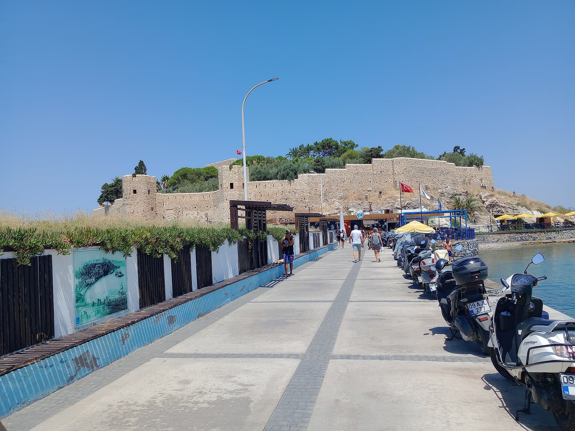
Visitors walking along the stone causeway to Güvercinada Kalesi in Kuşadası, with the fortress's stone walls, a Turkish flag, and scooters parked along the seaside railing under a clear blue sky.

A walled islet on a 350-metre causeway, ten minutes from the cruise berth — Kuşadası's emblem, and its best hour is before sunset.

Byzantine in origin, the fortress was rebuilt under the Ottomans; guidebooks credit Barbaros Hayreddin, the municipality says Byzantine, and the UNESCO tentative file calls it a medieval trading-route fortification — the attribution is genuinely unsettled. The outer walls are dated: an inscription records İlyas Ağa, governor of Sığla, raising them in 1826 with stone barged from Yılancıburnu.

90 minEntry is now ticketed and museum passes are not accepted — the island and its museum are run by the municipality rather than the Ministry. Much of the web, including pages updated in 2026, still describes entry as free, and the municipality's own page does not mention the museum at all.Sources conflict on the current entry price and on whether foreign visitors pay a different rate. Check at the gate rather than trusting a published figure.The causeway is exposed and unshaded; in July and August walk it before 10:00 or after 18:00.
+1 more to know
Crowding tracks the cruise schedule rather than the clock — the island empties completely once the ships sail.
Look for: The 1826 inscription over the gate, flanked by one pentagonal and one round tower; the 14.5-metre fin whale skeleton, stranded here in 1998; and the walls' full circuit, low enough to walk in twenty minutes.
Verified · · 16 min to Kaleiçi · 30 min to Ladies Beach (Kadınlar Denizi)
Rank2
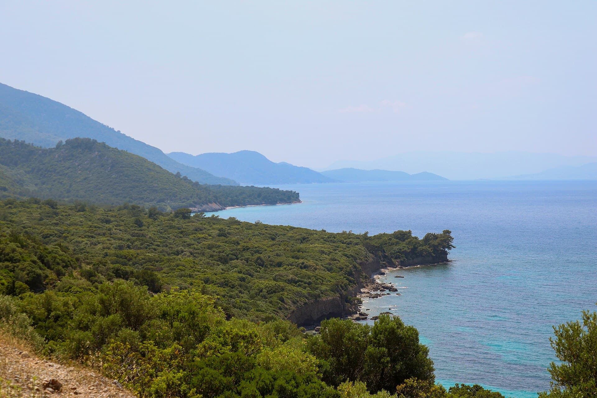
View along the forested coastline of Dilek Peninsula National Park, where a pine-covered mountain ridge drops into the turquoise Aegean Sea, with hazy headlands receding into the distance.

A 1966 national park where the mountain drops straight into the sea: four swimmable coves, and Samos close enough to pick out houses.

Declared in 1966, the peninsula protects Mount Mycale — the Mykale of Herodotus, where the Greek fleet destroyed the Persian camp in 479 BC. The Büyük Menderes delta was added in 1994, bringing the total to 27,598 hectares and joining two very different landscapes: a limestone ridge running to 1,237 metres, and the silt plain whose river closed the harbours of Priene, Miletus and Ephesus.

300 minThe canyon route and the Karasu–Kavaklı botanical trail close for the whole fire season, and the entire park has been shut to visitors on fire-risk days.Zeus Cave, at the entrance, has its own contested closure status — see its entry.Vehicle entry is capped at 1,505 across the four day-use coves and read by plate recognition; when full, cars enter only as others leave. Roadside parking is towed.
+3 more to know
Last entry 17:30 in summer (1 May–31 Oct) and 17:00 in winter, with exit enforced an hour later.Walking outside the four designated coves is prohibited; camping and fires are banned outright.No shops past the gate — carry water and food.
Look for: The coves in order west: İçmeler shallow and sandy, Aydınlık pebbled and deeper, then Kavaklıburun and Karasu with Samos filling the horizon. Wild boar cross the road at dusk; the delta side holds Dalmatian pelicans.
Rank3
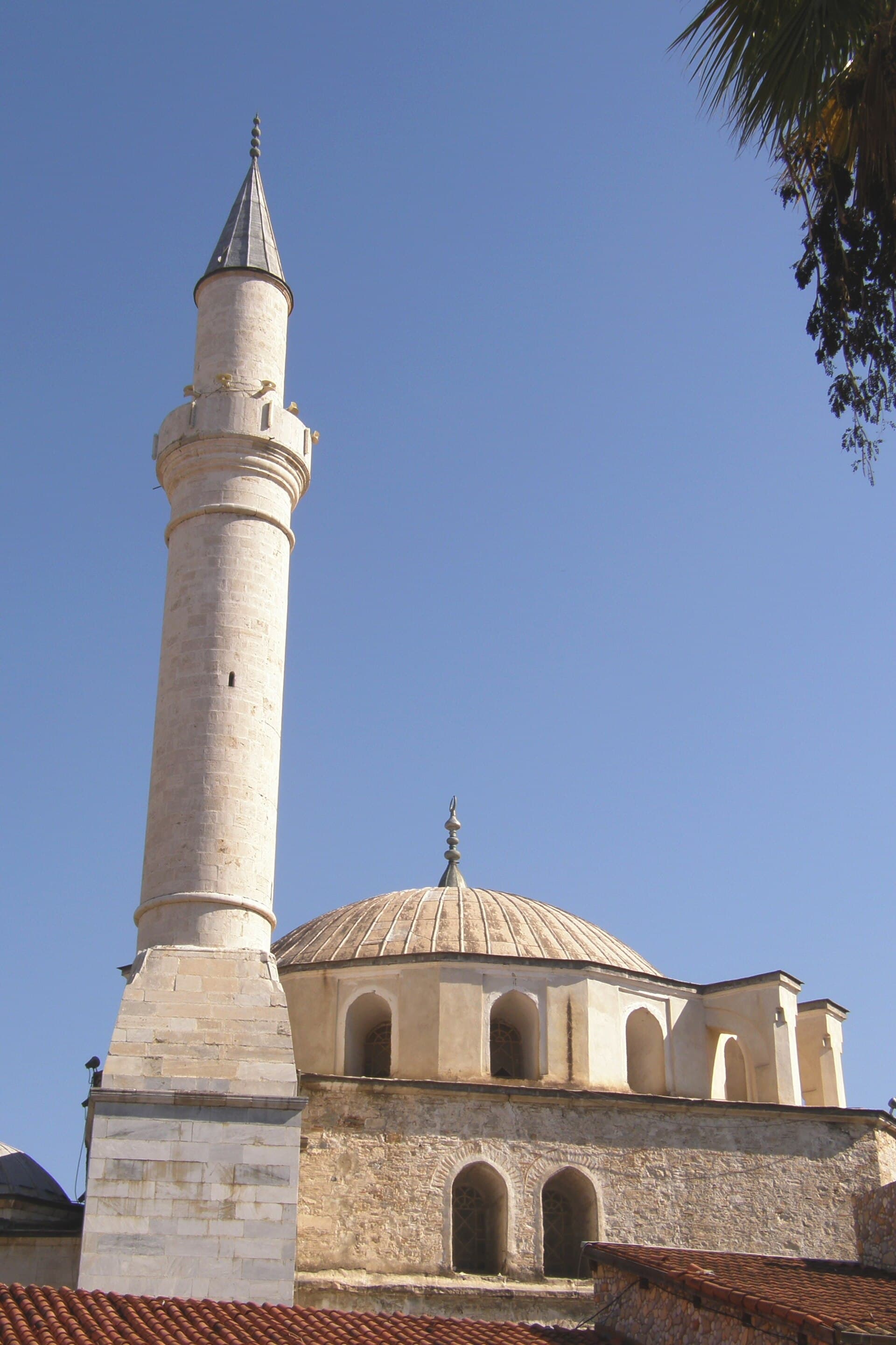
Looking up at the stone minaret and ribbed lead dome of the Ottoman-era Kaleiçi Mosque (Öküz Mehmet Paşa Camii) in Kuşadası's old town, set against a clear blue sky with palm fronds at the frame's edge.

Kaleiçi

Neighbourhood

The old town inside the vanished walls: one Ottoman mosque, a grid of cobbled lanes, and the hardest sell on the Turkish Aegean.

Kuşadası was Scala Nova to the Genoese and Venetians who traded here after Ephesus's harbour silted up, and Ephesus Neopolis to the Byzantines before them. The quarter took its present shape around 1618, when Grand Vizier Öküz Mehmet Paşa endowed a mosque, a hamam, a caravanserai and a circuit of walls in one programme. Most of the walls have gone; the street plan they enclosed has not.

90 minBarbaros Hayrettin Bulvarı is the most aggressive shopping street in the region: expect to be walked backwards into carpet and leather showrooms, and treat "come see my shop, no buy" as a twenty-minute commitment.Shops endorsed or recommended by cruise lines are not automatically cheaper or more honest.Busiest roughly 10:00–14:00 when ships are alongside, and empty once they sail — the same lanes read entirely differently three hours apart.
+1 more to know
Cobbles are uneven and the streets climb.
Look for: Kale Kapısı, the surviving gate on Barbaros Hayrettin Bulvarı with the traffic police above it; the 1618 mosque set into the bazaar; and the fish market building a block toward the harbour.
Verified · · 16 min to Güvercinada (Pigeon Island) · 26 min to Ladies Beach (Kadınlar Denizi)

Worth your time

Worth your time

A second day earns you these.

Rank1
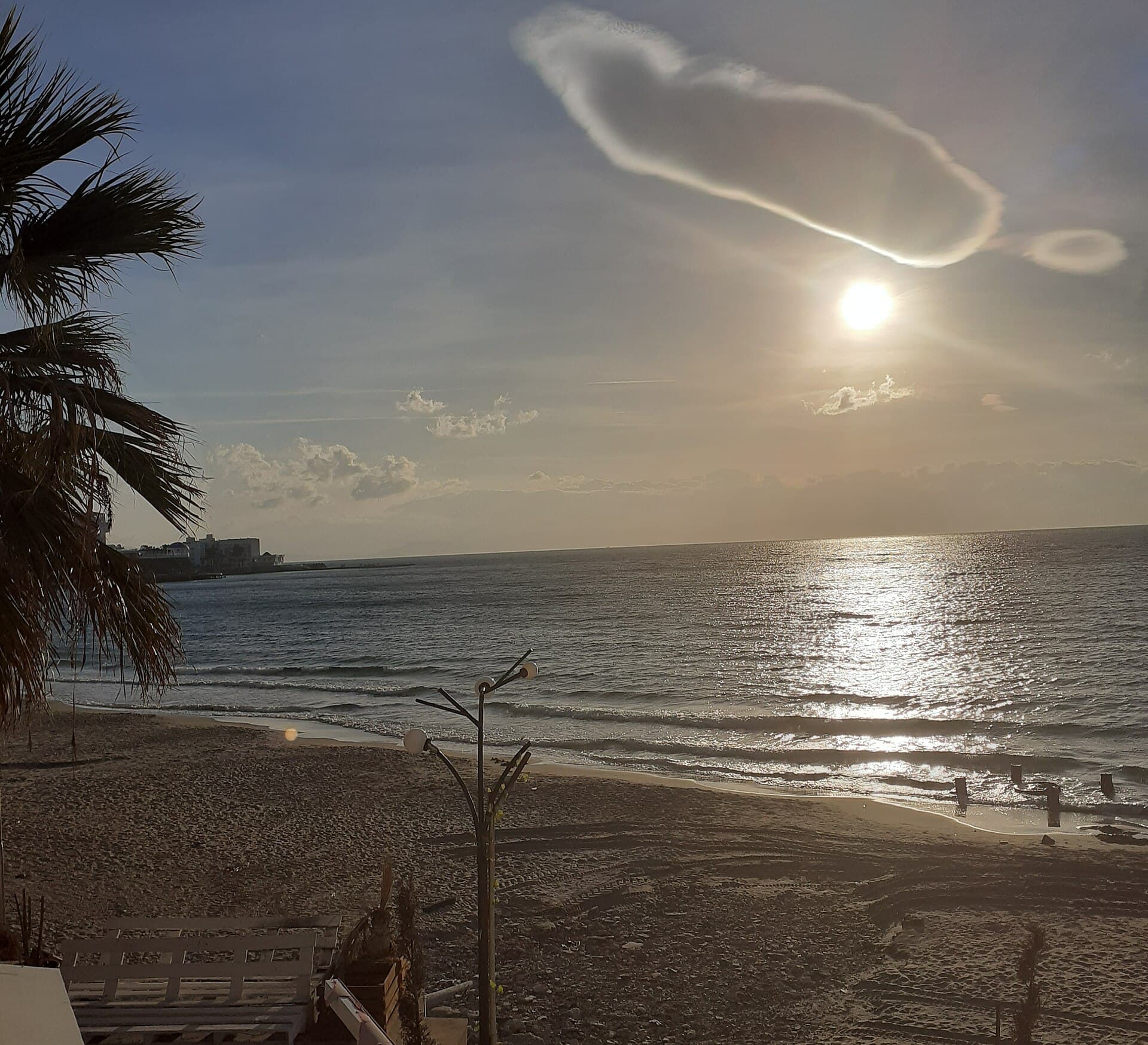
Golden-hour view over the sandy shore of Ladies Beach (Kadınlar Denizi) in Kuşadası, with a palm tree in the foreground, gentle waves reflecting the low sun, and the town silhouette visible across the bay.

Kuşadası's most famous beach and its most oversold: a one-kilometre bay that is genuinely good before 10:00 and a scrum by noon.

The Turkish name means Women's Sea: under the Ottomans this bay was set aside for women to swim apart from men. The segregation is long gone and the name is all that survives of it. In the resort era the slope behind the sand filled with bars, and Kadınlar Denizi became the centre of Kuşadası's nightlife as much as its swimming — the two audiences now share the same thousand metres.

150 minSunday is the worst day — domestic visitors from Aydın and İzmir fill it.Reviews split sharply between "best beach in town" and "dirty and crowded"; both describe the same place at different hours, so check the date and time on any review you rely on.The bay is small and the bar strip immediately behind it runs late, so it is not a quiet family beach in season — Long Beach or Green Beach are the alternatives.
+1 more to know
Facilities, loungers and beach cafés close from roughly November to April.
Look for: Free loungers exist but are gone by about 10:30. The clearest water and the emptiest sand are both in the first hour after sunrise; Green Beach, two kilometres south, is the fallback when this bay fills.
Verified · · 26 min to Kaleiçi · 30 min to Güvercinada (Pigeon Island)
Rank2
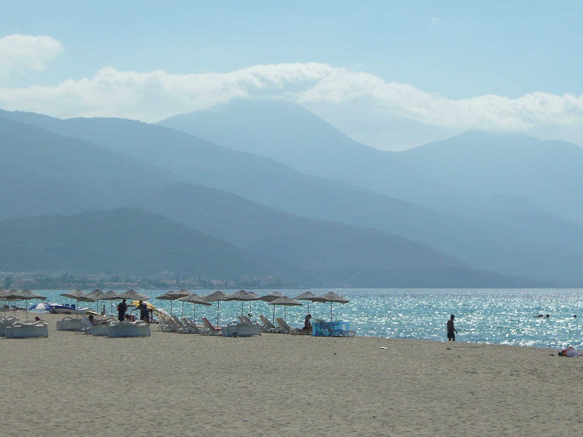
Straw umbrellas and white sun loungers line a wide sandy beach on Kuşadası's Long Beach near Davutlar, with calm, shallow turquoise water glittering in sunlight and hazy mountains rising across the gulf.

Twelve kilometres of fine sand running south to the national park: shallow, family-shaped, and free where no beach club has claimed it.

Not a single beach but a marketing name for the strip running from Yavansu south to Güzelçamlı, subdivided by the resorts built along it: Silver Sand, Paradise and Green Beach are club and hotel frontages on one continuous shore, not separate places. Kuşadası's package-holiday industry grew up along this road from the 1980s, which is why the beach is named in English at all.

240 minSunbed rental and beach clubs shut from roughly November to April, when the public stretches have no shade, no showers and no lifeguard.The name covers 12 km with no single access point — "Long Beach" on a booking site can mean anywhere between Kuşadası and Güzelçamlı, so check which hotel frontage is meant before booking.Blue Flags along this shore belong to individual hotel sections, not to the strip as a whole.
+1 more to know
Reaching the middle of the strip without a car means a Davutlar dolmuş.
Look for: Water still only about waist-deep 40 metres out — the reason families choose this coast over Bodrum's. Free public stretches sit between the club frontages; look for the municipal showers and cabins rather than a row of matched loungers.

If you have longer

If you have longer

Keep these compact stops in mind when you build your trip.

Kadıkalesi (Anaia)

Archaeological site

Anaia guarded the Samos strait and served as one of Byzantium's Aegean customs stations. Excavation since 2001 has cut stepped trenches through occupation running from prehistory to the Ottomans, and uncovered a 12th-century church, a 5th-century sacred spring, workshops making goods for Latin buyers, and lead seals tying the site to Mediterranean trade.

A working excavation, not a prepared site: no ticket office, no marked route, no guaranteed access. Entering the trenches needs the excavation team's permission and they are only on site during the summer dig season.Visitor paths and a reception point were announced as being in their final stage in 2023 and had still not opened as of August 2026 — treat any source describing it as an open attraction with suspicion.The mound is unshaded, the footing is loose, and there is no water on site.
60 minOpen in Maps

Öküz Mehmet Paşa, twice grand vizier to Ahmed I, built it in 1618 as the strongroom of his new port town: two storeys around a courtyard, walls thick enough to hold merchants' goods against pirates. It served as a hotel from 1965 until the tenant was removed in 2014, then sat idle while a planned municipal museum never materialised.

Closed and empty. The Aydın Directorate of Foundations tendered a 25-year restore-and-operate lease in June 2026, with a 220 million TL investment requirement, and the first years go to restoration before any operation begins. Expect hoardings and no interior access for years.Tour listings and travel sites still present it as an open attraction or a working hotel. It is neither.Once scaffolding goes up, even the exterior will be obscured.
15 minOpen in Maps

Protected since 1966, when the Dilek Peninsula became one of Türkiye's earliest national parks — which is why a shoreline this close to a major resort carries no hotels at all. İçmeler is the first and shallowest of the four day-use coves, closest to the gate, and it absorbs the largest share of the park's daily vehicle capacity.

Inside the park, so subject to the vehicle cap, the plate-recognition gate and last-entry times; arrive before 09:00 in July and August or expect to queue at the barrier.Picnicking is confined to designated cove areas and walking beyond them is prohibited. No camping, fires or overnight stays.Facilities are basic and seasonal, and there are no shops past the gate.
180 minOpen in Maps

Karasu and neighbouring Kavaklıburun sit at the western tip of Mount Mycale, the ridge below which the Greeks broke the Persian army in 479 BC, and which now forms the Turkish side of a strait 1.6 km wide at its narrowest. The botanical trail between the two coves runs through the transitional forest that makes the park a recognised flora reserve.

The botanical trail to Kavaklı and the canyon route are both shut for the entire fire season.The furthest cove from the gate, so a wasted drive if the park hits its vehicle cap while you are still in the entry queue.Pebble shore and deeper water make it a poor choice for small children.
+1 more to know
No shops beyond the gate — carry water. Exit is enforced an hour after last entry.
180 minOpen in Maps

Cave of Zeus

Natural site

The name is local folklore rather than ancient cult: the tale of Zeus bathing here to hide from Poseidon is a modern telling, and the wishing tree at the mouth is a village custom. What is real is the hydrology — a sinkhole fed by cold groundwater off Mount Mycale, dropping to around ten metres in places.

Opening status is contested and could not be established. The national park administration closed it after a landslide risk report; reopening was reported afterwards; a further closure was reported in 2026. Assume it may be shut and check before making the trip.Swimming inside was prohibited even before the closures — the water is cold and drops to around ten metres.Almost every guide, tour listing, the Ministry's culture portal and the municipality's own page present it as a normal open stop with no caveat at all.
+1 more to know
It sits at the national park entrance, so a visit is bound by the park's gate hours and vehicle cap.
20 minOpen in Maps

Raised between 1613 and 1618 by Öküz Mehmet Paşa, grand vizier and son-in-law of Ahmed I, as part of the complex that also gave the town its caravanserai, hamam and walls. Square plan, one dome, a three-bay porch and a minaret at the north-west corner, in cut and rubble stone with brick and marble. It was officially renamed for its founder in 2019.

An active mosque in a dense bazaar: avoid the five prayer times and Friday midday entirely, cover shoulders and knees, remove shoes.Naming is inconsistent across sources — it appears as Kaleiçi Camii on older maps and signage, and under its founder's name only since the 2019 renaming.There is no separate visitor entrance.
20 minOpen in Maps

Güzelçamlı

Neighbourhood

Güzelçamlı sits at the foot of Mount Mycale where the peninsula road ends, 26 km from Kuşadası. It is a neighbourhood of Kuşadası rather than a resort in its own right, and its whole modern character comes from being the last settlement before the national park gate: pensions and fish restaurants rather than all-inclusive blocks, and a season that starts and ends with the park's.

Strictly seasonal: much of the seafront shuts from late October to April, and out of season there is little reason to make the 26 km trip unless you are walking.Weekend and public-holiday traffic on the single road in from Davutlar backs up badly in July and August, and the park's vehicle cap lengthens the queue further.Arriving by dolmuş sidesteps the vehicle cap entirely — the most useful thing to know about reaching the park.
90 minOpen in Maps

Kale Kapısı

Historic site

Part of the seventeenth-century circuit that made Kuşadası a walled port, from the same programme of patronage as the mosque and caravanserai. The walls were pulled down as the town grew seaward; this gate survived because the road ran through it. It now marks the boundary between Barbaros Hayrettin Bulvarı and Kahramanlar Caddesi, and its upper chamber is in municipal use.

Not a site — a gate you pass through in under a minute, with no interior access; the upper floor is a police office and is closed to visitors.It stands at the top of the hardest-selling stretch of the bazaar, so stopping to photograph it reliably attracts shop touts.Attribution of the walls varies between sources.
10 minOpen in Maps

Kirazlı Village

Neighbourhood

Kirazlı — 'with cherries' — sits on the plain behind Kuşadası where cherry, fig, olive, pomegranate and walnut grow alongside tobacco, sesame and chickpeas. It became a fixture of cruise excursions because it is close, green and photogenic, and a village breakfast trade grew up around that demand rather than the other way round.

Time it against the ships: between roughly 09:00 and 13:00 on a multi-ship day the village is worked by coach groups and the village breakfast venues are block-booked by operators.Sources disagree on distance — 11 km is quoted from the town centre, 17 km and 30 minutes from the cruise berth.There is no single sight here. If you want ruins or a beach, this is the wrong stop.
120 minOpen in Maps

One of only four free public beaches in Kuşadası to hold a Blue Flag, alongside Kadınlar Denizi, Kuştur and Güvercinada — the district's other twenty-one flags all belong to hotels and holiday villages. That split is the clearest single description of how this coast works: most of the certified shoreline sits behind a reception desk.

Fills with local families at weekends rather than with foreign visitors, which changes the atmosphere more than the numbers do.A municipal beach, so facilities are basic and close out of season.Blue Flag status is renewed annually and is not a permanent designation — re-check it for the year you travel.
150 minOpen in Maps

Kuşadası's resident population is about 130,000 and multiplies several times over in summer, and the covered market is where the permanent town shops. The weekly pattern is the ordinary Turkish one — a produce pazar twice a week, a textile pazar once — held under a permanent roof rather than on a closed street.

Three days only — Tuesday, Wednesday and Friday. On the other four days the hall is shut and there is nothing to see.Produce days and the textile day are effectively different markets with different traders.It is uphill and inland from the seafront, too far to fold into a short port call.
60 minOpen in Maps

Getting there and away

Verified routes from Kuşadası.

Door-to-door times and fare ranges, checked leg by leg. Only routes where every leg verified are listed.

Getting around

Türkiye, for scale

Where it sits

See this city in the wider shape of Türkiye.

The map will load as it approaches the viewport.