TurQuosian

Eastern Türkiye

Mount Ararat

A palace, a peak, and a permit

Ağrı Dağı is Türkiye's highest peak, and most visitors only ever look at it: a summit bid needs four to five days, most stay barely a night. This guide follows that majority — İshak Paşa Palace, the mountain as a view, one night in Doğubayazıt. The climb is real but separate: guide, permit, weeks of lead time, a military-restricted upper mountain — covered on its own page.

Highest peak
5,137m
Base town
Doğubayazıt
Stay
1–2 nights
Summit climb
4–5 days, permit required
Nearest airport
Iğdır (IGD)
Iran border
35km east

Every published place in one city guide

What to see in Mount Ararat.

Start with the essentials, add what genuinely interests you, and leave the rest for another visit. Every place includes a concise story, practical timing, a Maps link, and a one-tap route planner action.

Make the route work

Anticipate the practical details.

Getting there

Fly into Iğdır (IGD, roughly 70km north) or Ağrı (AJI, roughly 100km west) — both have daily Istanbul flights of around two hours ten minutes, but rental cars at either need booking well in advance. Overland from Istanbul is a genuine two-day drive or a 23-hour direct bus; neither is realistic for most itineraries. Van, further south, is a workable alternative base for some routings.

Getting around

İshak Paşa Palace is about 3km from town — dolmuş or taxi, a short trip either way. The Ararat viewpoint is on the road out of town toward the mountain; a rented car or taxi gives you the flexibility to come back if cloud ruins the first attempt. Durupınar is roughly 16km southeast, taxi or organised tour only — there's no regular dolmuş. None of this applies if you're climbing: your agency handles transport to the trailhead as part of the arrangement.

Money

Carry Turkish lira; cards work in Doğubayazıt's hotels and larger restaurants but smaller stalls and taxis expect cash. Climbing costs are typically settled directly with your agency, often quoted in USD or EUR alongside a TL equivalent — get an itemised breakdown rather than a single bundled figure.

Connectivity

4G is reliable in Doğubayazıt's town centre from all major Turkish carriers, but drops out on the approach roads to the palace and the viewpoint, and disappears well below the summit on the mountain itself. Download offline maps before heading out, and don't rely on a signal for climb-day communications — agencies carry radios or satellite phones for that reason.

Etiquette

A conservative, Kurdish-majority border town — dress modestly, especially away from the hotel strip. Military and gendarmerie checkpoints are routine this close to the border; carry ID or your passport and expect to show it without incident.

Safety and comfort

Doğubayazıt itself functions as an established tourist gateway, not a conflict zone — but it sits on a genuinely sensitive international border, and standard border-region caution applies: carry ID, expect checkpoints, and check current government travel advisories for the wider region before you go. None of this affects a Layer 1 visit to the palace and the viewpoint. Climbing the mountain is a separate matter with its own permit, licensed-guide and military-restricted-zone requirements, covered on the climbing POI itself rather than here, because almost nobody doing this trip needs them.

Essential

Don’t leave without

If you only have one day, this is the day.

Rank1
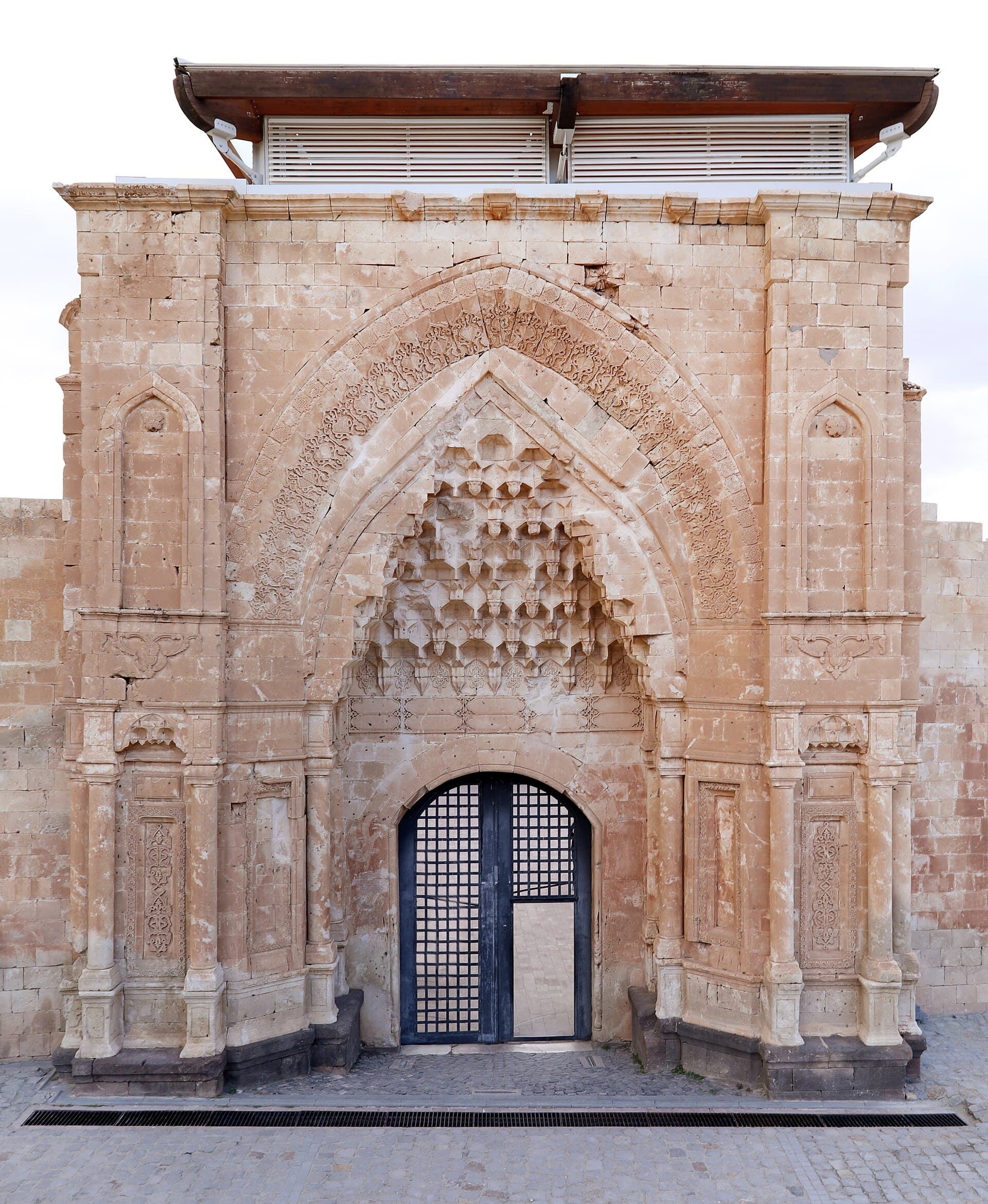
Carved stone entrance portal at İshak Paşa Palace's main courtyard facade

İshak Paşa Palace

Historic site

Ninety-nine years and two generations to build, half destroyed within a century — Türkiye's most theatrical Ottoman-era ruin.

Begun in 1685 by the regional beg Çolak Abdi Paşa, finished 99 years later in 1784 by his descendant İshak Paşa, who named it for himself. Ottoman patronage, Persian and Armenian craftsmanship, Seljuk stonework. An 1840 earthquake — the same one that killed some ten thousand people on the mountain's slopes and buried the monastery of St Jacob — began its ruin; the 1877–78 war and WWI finished it.

60 minOpening-hours sources disagree specifically about Mondays — one official page lists a restricted 13:00-16:00 window, another lists no Monday exception at all. Confirm before planning a Monday visit.The palace is genuinely semi-ruined throughout: roofless halls and open courtyards, with modern glass-and-wood shelters over the worst-damaged rooms. Expect a ruin, not a restored interior.A fully exposed hilltop site with no significant shade.
+1 more to know
The older citadel visible across the ravine has no confirmed visitor access, hours or safe route from the palace side — admire it from the terrace rather than trying to reach it.
Look for: The harem–selamlık split; carved portals mixing Seljuk, Persian and Baroque motifs; modern glass-and-wood shelters over worst-damaged rooms. Across the ravine, the ruined citadel of Eski Beyazıt — too poorly documented to send you there.
Rank2
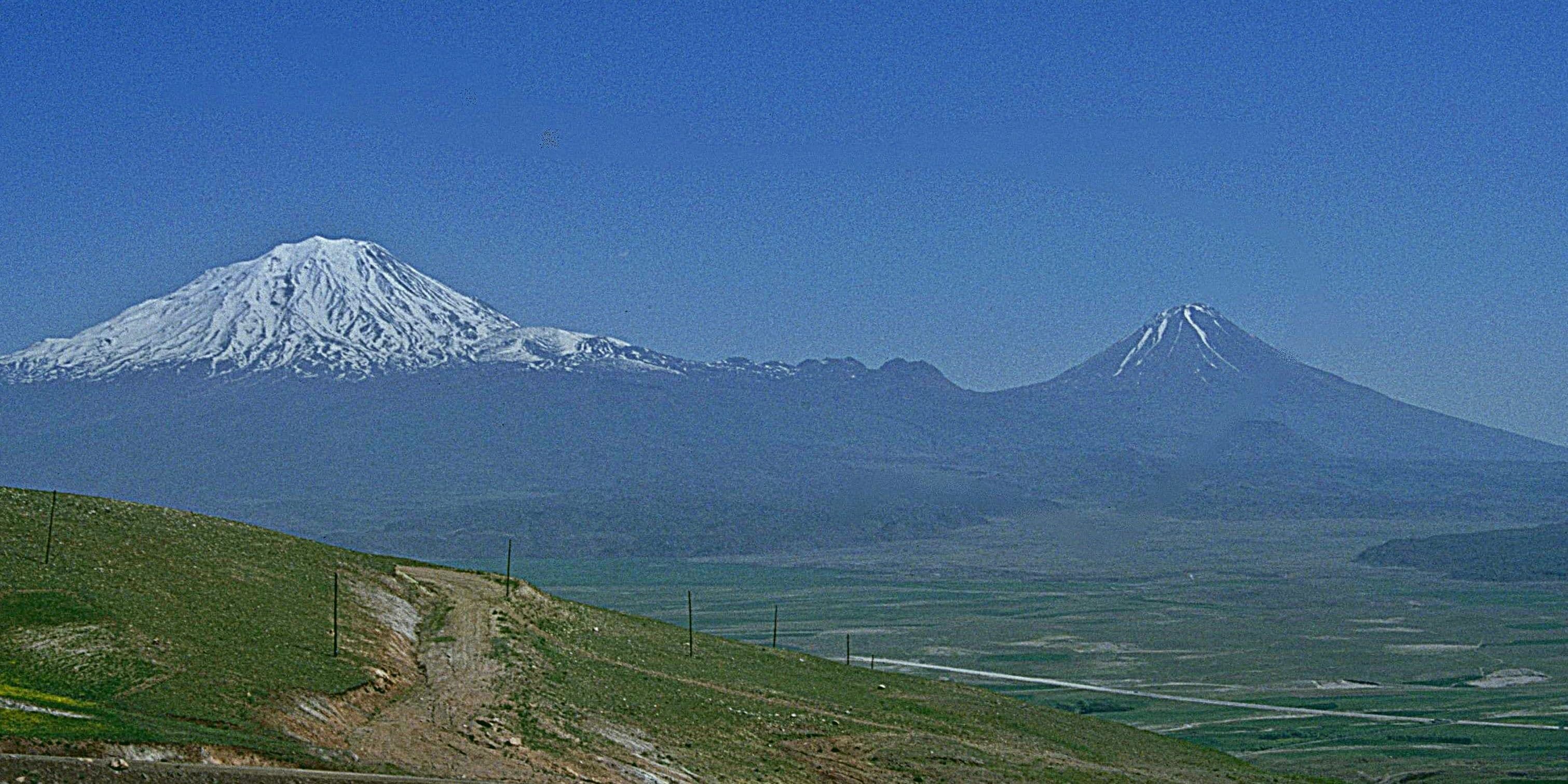
Snow-capped Mount Ararat and Little Ararat's cone peak under a clear sky

A roadside pull-off where Ararat stops being a backdrop and becomes the entire view — weather, not distance, decides whether you get it.

Ararat is Türkiye's highest point at 5,137m, a dormant volcano near where Türkiye, Armenia and Iran meet. Ağrı Dağı is the Turkish name; the Genesis account that made it famous in the West is older. Friedrich Parrot made the first recorded modern ascent on 9 October 1829, guided by the young Armenian scholar Khachatur Abovian. Sacred, fought over and climbed ever since — rarely all by the same visitor.

30 minArarat is cloud-covered more days than not; a single stop is not guaranteed a clear view. If the mountain matters to your trip, build in a spare morning rather than one pass-through.This is a roadside pull-off, not a managed viewpoint — no confirmed barrier, signage or dedicated parking. Take the usual care stopping on a rural road.The coordinates here come from a single crowdsourced source (Komoot), not an official listing. Treat the pin as approximate, not a precise address.
Look for: Two summits, not one: Büyük Ağrı (Great Ararat, 5,137m) and, beside it, the near-perfect volcanic cone of Küçük Ağrı (Little Ararat, 3,896m). Snow lingers on the upper slopes most of the year; cloud hides the peak more days than it doesn't.
Rank3
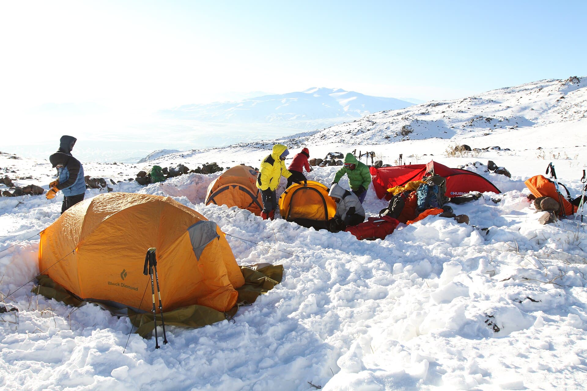
Climbers' tents pitched on the snowy slope of Mount Ararat's high camp

Not a hike, and not what most visitors here are doing: a permitted, guided, 4–5 day expedition into a military security zone.

Friedrich Parrot's 1829 first ascent, guided by Khachatur Abovian, opened the mountain to organised climbing; access has been state-controlled ever since, tightening into today's permit-and-guide system given the summit's position on the Türkiye–Armenia–Iran frontier. Rules tightened again after a string of climber deaths, adding mandatory first-aid training and rescue communications to every group.

7200 minA real mountaineering objective with glacier travel above roughly 4,800m. Prior altitude and ice experience matter, whatever an outfitter's marketing implies.The upper mountain is a designated military security zone. Independent or unpermitted climbing is illegal, not merely discouraged, and checkpoints on the approach check paperwork.Permit fee and application lead time are genuinely disputed between sources — figures range from $50 to $70 per person and from two weeks to two months. Confirm current numbers with your licensed agency before planning around either.
+1 more to know
Outside roughly late June to early September the route is considered unsafe and agencies will not run it, regardless of what dates you request.
Look for: The Ahora landslide scar from the 1840 earthquake, on the north flank. The glacier line near 4,800m, where trekking becomes ice climbing. Little Ararat's cone alongside the ascent — an ice cave reported on its flank is unverified here.

Worth your time

Worth your time

A second day earns you these.

Rank1

Durupınar Site (Noah's Ark formation)

Natural site

A boat-shaped ridge that pilgrims and geologists both visit, for opposite reasons — only one side has since published the evidence.

Exposed by earthquake and heavy rain in 1948, photographed from the air by a Turkish army captain in 1959, and promoted internationally from 1977. A 1960 survey found no archaeological remains on site. Geological research since — including scientists who started from opposing convictions — agrees it is a natural formation of limonite in tilted rock, not a vessel. Administered since 2011 by a nearby university.

45 minIndependent geological research describes a natural rock formation, not a vessel. On-site panels lean toward the ark interpretation — treat that as the site's own marketing, not the scientific record.It sits on Mount Tendürek, roughly 16km from Doğubayazıt and 29km from Ararat's own summit — a separate mountain, not a stop on the way up or down Ararat itself.Close to the Iran border. The visitor site itself is open and unrestricted, but this is still a sensitive frontier area.
Look for: The 164m ridge itself, best appreciated from the viewing platform rather than the on-site panels, which lean toward the ark reading. It sits on Mount Tendürek — a separate mountain, not on Ararat and not within sight of it.
Open in Maps

If you have longer

If you have longer

Keep these compact stops in mind when you build your trip.

Doğubayazıt

Neighbourhood

For most of its history this Kurdish-majority town mattered more than Ağrı, the provincial capital, because it commanded the road to Iran rather than because it was beautiful. Sulphur mining began nearby in 1920. The old hilltop town, Eski Beyazıt, was abandoned for the site below; the modern town is what you actually stay in.

This is a functional base, not a sightseeing destination in itself — go in with that expectation and the town won't disappoint you.A genuine frontier town on a sensitive international border. Check current government travel advisories for the wider region before you go, as you would for any border area — this is routine caution, not a specific warning about the town itself.Basic tourist infrastructure by the standards of Türkiye's western coast: a real hotel and restaurant scene, but not a resort one. Book ahead in July–August, the overlapping peak for both climbers and sightseers.
90 minOpen in Maps

Getting there and away

Verified routes from Mount Ararat.

Door-to-door times and fare ranges, checked leg by leg. Only routes where every leg verified are listed.

Getting around

Türkiye, for scale

Where it sits

See this city in the wider shape of Türkiye.

The map will load as it approaches the viewport.